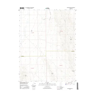
2017 Map of Cockscomb Ridge
USGS Topo · Published 2017About this map
Snake Valley and the Confusion Range dominate this 2017 study of the high desert along the Juab and Millard County line. The landscape is defined by its topographic extremes, transitioning from the broad flats of the valley floor to the prominent uplift of Cockscomb Ridge and the aptly named Disappointment Hills in the southeast. This area of western Utah is characterized by remote desert basins and interior drainage patterns, evidenced by the presence of the Salt Marsh Range. Transportation through this arid terrain is limited to primitive routes such as Horse Kill Rd and Confusion Gap Rd, which follow natural breaks in the mountains. The map provides a clear look at the Public Land Survey System grid (Township 14 and 15 South), which remains the primary administrative framework for this unpopulated expanse of the Great Basin.
Find a feature on this map
13 named features on this map. Tap any name to fly to it.
Don’t see what you’re looking for? This feature index may not catch every label — zoom into the map to look around manually.
Map Details
Editions of this 2017 Cockscomb Ridge Map
This is the sole edition of this map. No revisions or reprints were ever made.
Other maps of this area

1908 · Fish Springs
USGS Topo · 1:250,000

1910 · Fish Springs
USGS Topo · 1:250,000

1953 · Delta
USGS Topo · 1:250,000

1958 · Delta
USGS Topo · 1:250,000

1959 · Cowboy Pass
USGS Topo · 1:62,500

1960 · Granite Mountain
USGS Topo · 1:62,500

1960 · Gandy
USGS Topo · 1:62,500

1961 · Trout Creek
USGS Topo · 1:62,500

1962 · Delta
USGS Topo · 1:250,000
1979 · Fish Springs
USGS Topo · 1:100,000