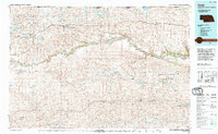
1994 Map of Cody
USGS Topo · Published 1994About this map
The Niobrara River carves a winding path through the Nebraska Sandhills in this 1994 topographic study, separating the higher tablelands of the Rosebud Indian Reservation to the north from the expansive Samuel R Mc Kelvie National Forest to the south. Small settlements like Cody, Merriman, and Eli follow the established transport corridor above the river, while the landscape below is dominated by an intricate network of valleys and flats, including Tombstone Valley and Connelly Flat.
Find a feature on this map
56 named features on this map. Tap any name to fly to it.
Don’t see what you’re looking for? This feature index may not catch every label — zoom into the map to look around manually.
Map Details
Editions of this 1994 Cody Map
This is the sole edition of this map. No revisions or reprints were ever made.
Other maps of this area

1948 · Spade Ranch
USGS Topo · 1:62,500

1949 · Big Falls
USGS Topo · 1:62,500

1949 · Steverson Lake
USGS Topo · 1:62,500

1949 · Turpin Lake
USGS Topo · 1:62,500

1950 · Spade Ranch
USGS Topo · 1:62,500

1950 · Powderhorn Valley
USGS Topo · 1:62,500

1950 · Kennedy
USGS Topo · 1:62,500

1950 · Kilgore
USGS Topo · 1:62,500

1950 · Cody
USGS Topo · 1:62,500

1950 · Doughboy
USGS Topo · 1:62,500