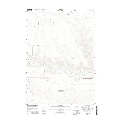
2014 Map of Cody SE
USGS Topo · Published 2014About this map
The Niobrara River winds through the central portion of this Nebraska landscape, cutting a distinct valley through the Sandhills. To the south, the boundary of the Sam R. McKelvie National Forest marks a significant transition in land use, encompassing a large area of protected prairie and woodland. Transportation in this area is defined by a sparse network of local routes, including Lehrman Rd in the north and the State Hwy Spur 16F, which provides access across the river via the Riemenschneider Bridge.
Find a feature on this map
8 named features on this map. Tap any name to fly to it.
Don’t see what you’re looking for? This feature index may not catch every label — zoom into the map to look around manually.
Map Details
Editions of this 2014 Cody SE Map
This is the sole edition of this map. No revisions or reprints were ever made.
Other maps of this area

1950 · Powderhorn Valley
USGS Topo · 1:62,500

1950 · Kennedy
USGS Topo · 1:62,500

1950 · Kilgore
USGS Topo · 1:62,500

1950 · Cody
USGS Topo · 1:62,500

1957 · Valentine
USGS Topo · 1:250,000

1959 · Valentine
USGS Topo · 1:250,000

1985 · Cooper Canyon
USGS Topo · 1:24,000
1985 · Cody East
USGS Topo · 1:24,000
1985 · Cody SE
USGS Topo · 1:24,000

1985 · Cody
USGS Topo · 1:100,000