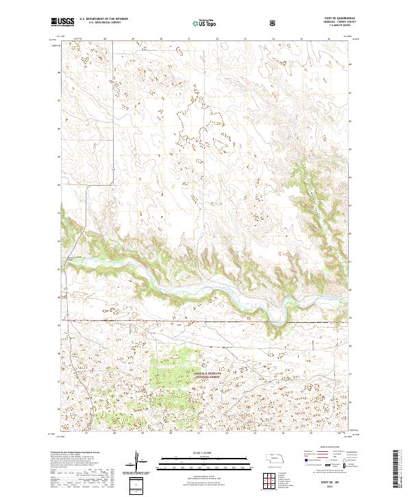
2021 Map of Cody SE
USGS Topo · Published 2021About this map
The Niobrara River carves a deep, winding path through the center of this Cherry County landscape, creating a distinct topographical contrast with the surrounding Sandhills. Along this river corridor, the Riemenschneider Bridge provides a critical crossing point for local transit through the river valley. To the south, the northern extent of the Samuel R McKelvie National Forest introduces a managed landscape of timber and grassland, while the northeast is marked by the steep descent of McCann Canyon. Water resources are sparse across the higher elevations, making localized features like Buckhorn Spring and the drainage of Dry Cr significant landmarks for understanding historical land use and cattle movement in this section of the Nebraska backcountry.
Find a feature on this map
12 named features on this map. Tap any name to fly to it.
Don’t see what you’re looking for? This feature index may not catch every label — zoom into the map to look around manually.
Map Details
Editions of this 2021 Cody SE Map
This is the sole edition of this map. No revisions or reprints were ever made.
Other maps of this area

1950 · Powderhorn Valley
USGS Topo · 1:62,500

1950 · Kennedy
USGS Topo · 1:62,500

1950 · Kilgore
USGS Topo · 1:62,500

1950 · Cody
USGS Topo · 1:62,500

1957 · Valentine
USGS Topo · 1:250,000

1959 · Valentine
USGS Topo · 1:250,000

1985 · Cooper Canyon
USGS Topo · 1:24,000
1985 · Cody East
USGS Topo · 1:24,000
1985 · Cody SE
USGS Topo · 1:24,000

1985 · Cody
USGS Topo · 1:100,000