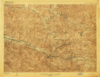
1906 Map of Coeur D'Alene District
USGS Topo · Published 1916About this map
Wallace serves as the central hub of this intensive mining landscape at the opening of the twentieth century, situated at the confluence of the South Fork Coeur d'Alene River and its tributary gulches. The terrain is defined by a dense network of high-production silver and lead operations, including the massive Bunker Hill and Sullivan Mine near Kellogg and the Tiger-Poorman Mine in the Canyon Creek corridor. The map details the critical industrial infrastructure of the era, from the Kellogg Tunnel to the Morning Mine Concentrator near Mullan. Transportation routes like the Oregon Railroad & Navigation Co. and the Northern Pacific Railway follow the river valleys, providing the essential links to outside markets. In the higher elevations of the Bitter Root Mountains, remote settlements like Sullivan and Delta appear alongside numerous named peaks and passes, including Glidden Pass and St. Regis Pass along the Montana border.
Find a feature on this map
171 named features on this map. Tap any name to fly to it.
Don’t see what you’re looking for? This feature index may not catch every label — zoom into the map to look around manually.
Map Details
Editions of this 1906 Coeur D'Alene District Map
3 editions found
Other maps of this area

1901 · Coeur D'Alene District
USGS Topo · 1:62,500

1903 · Coeur D'Alene District
USGS Topo · 1:62,500

1906 · Coeur D'Alene District
USGS Topo · 1:62,500

1909 · Cataldo
USGS Topo · 1:125,000

1911 · Cataldo
USGS Topo · 1:125,000

1914 · Avery
USGS Topo · 1:125,000

1917 · Avery
USGS Topo · 1:125,000

1932 · Trout Creek
USGS Topo · 1:125,000

1935 · Trout Creek
USGS Topo · 1:125,000

1936 · Trout Creek
USGS Topo · 1:125,000