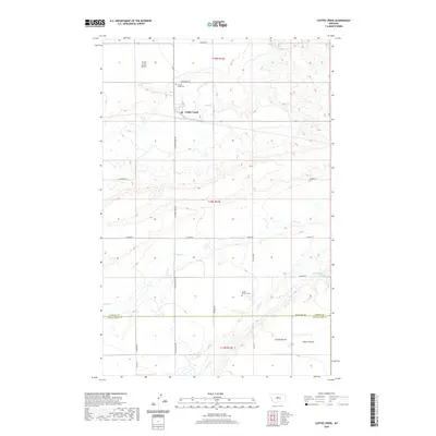
2020 Map of Coffee Creek
USGS Topo · Published 2020About this map
The small settlement of Coffee Creek serves as a focal point for this rural Montana landscape, positioned where the central agricultural corridor meets the breaks of the Judith Basin. The terrain is defined by elevated landforms such as Arrow Creek Bench and Coyote Bench, which separate the drainage systems of Coffee Cr and Wolf Cr. For those researching local history or genealogy, the presence of Coffee Creek Cem and the Strouf Pioneer Cem provides a tangible link to the early ranching and farming families of the region.
Find a feature on this map
24 named features on this map. Tap any name to fly to it.
Don’t see what you’re looking for? This feature index may not catch every label — zoom into the map to look around manually.
Map Details
Editions of this 2020 Coffee Creek Map
This is the sole edition of this map. No revisions or reprints were ever made.
Other maps of this area

1890 · Fort Benton
USGS Topo · 1:250,000

1892 · Fort Benton
USGS Topo · 1:250,000

1897 · Fort Benton
USGS Topo · 1:250,000

1954 · Great Falls
USGS Topo · 1:250,000

1954 · Lewistown
USGS Topo · 1:250,000

1957 · Great Falls
USGS Topo · 1:250,000

1959 · Lewistown
USGS Topo · 1:250,000
1970 · Big Spring
USGS Topo · 1:24,000
1978 · Stanford NE
USGS Topo · 1:24,000
1978 · Strouf Island
USGS Topo · 1:24,000