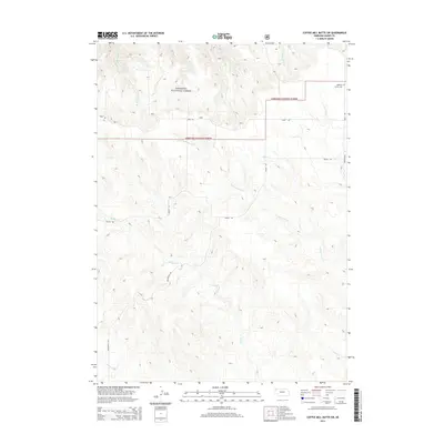
2014 Map of Coffee Mill Butte SW
USGS Topo · Published 2014About this map
The Nebraska National Forest dominates the northern landscape of this Dawes County region, where the high plains break into a complex network of drainage basins. The area is defined by the headwaters of numerous streams, including Cottonwood Creek and Willow Creek, which carve through the terrain south of the forest boundary. For those researching local families, Highland Center Cemetery stands near the intersection of Highland Road and Table Road at the northeastern edge of the sheet. The map reveals a land divided by a grid of rural routes like Hough Road and Hollibaugh Road, illustrating the intersection of federal forest conservation and private ranching interests in this corner of the Nebraska Panhandle.
Find a feature on this map
15 named features on this map. Tap any name to fly to it.
Don’t see what you’re looking for? This feature index may not catch every label — zoom into the map to look around manually.
Map Details
Editions of this 2014 Coffee Mill Butte SW Map
This is the sole edition of this map. No revisions or reprints were ever made.
Other maps of this area

1946 · Box Butte Reservoir West
USGS Topo · 1:24,000

1948 · Box Butte Reservoir West
USGS Topo · 1:24,000

1948 · Box Butte Reservoir East
USGS Topo · 1:24,000

1951 · Marsland
USGS Topo · 1:62,500

1955 · Alliance
USGS Topo · 1:250,000

1957 · Alliance
USGS Topo · 1:250,000

1958 · Alliance
USGS Topo · 1:250,000

1980 · Crow Butte
USGS Topo · 1:24,000
1980 · Coffee Mill Butte SE
USGS Topo · 1:24,000
1980 · Coffee Mill Butte
USGS Topo · 1:24,000