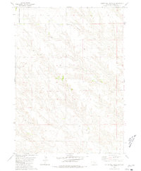
1980 Map of Coffee Mill Butte SE
USGS Topo · Published 1981About this map
Nebraska National Forest lands occupy the northwestern corner of this Dawes County landscape, where the high plains meet the intricate drainage systems of the Panhandle. The area is defined by a series of branching seasonal waterways, most notably the winding paths of Pebble Creek and Pepper Creek to the north, and Cottonwood Creek in the south. This terrain reflects a classic Western ranching and homesteading pattern, where life centered around reliable water sources and localized education.
Find a feature on this map
7 named features on this map. Tap any name to fly to it.
Don’t see what you’re looking for? This feature index may not catch every label — zoom into the map to look around manually.
Map Details
Editions of this 1980 Coffee Mill Butte SE Map
This is the sole edition of this map. No revisions or reprints were ever made.
Other maps of this area

1946 · Box Butte Reservoir West
USGS Topo · 1:24,000

1947 · Box Butte NW
USGS Topo · 1:24,000

1948 · Box Butte Reservoir West
USGS Topo · 1:24,000

1948 · Box Butte Reservoir East
USGS Topo · 1:24,000

1949 · Box Butte NW
USGS Topo · 1:24,000

1955 · Alliance
USGS Topo · 1:250,000

1957 · Alliance
USGS Topo · 1:250,000

1958 · Alliance
USGS Topo · 1:250,000
1966 · Chadron 3 SW
USGS Topo · 1:24,000

1970 · Chadron 3 NW
USGS Topo · 1:24,000