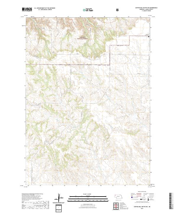
2021 Map of Coffee Mill Butte SW
USGS Topo · Published 2021About this map
The Nebraska National Forest dominates the northern reaches of this Dawes County landscape, where the terrain is carved by a network of seasonal drainages including Cottonwood Creek and Willow Creek. The map documents a rural transition from the protected forest highlands down toward the expansive ranch lands of the Pine Ridge region. Evidence of early twentieth-century community life is centered at the Highland Center Cemetery on the northeastern edge, near the junction of Highland Road and Table Road. Local travel and access are facilitated by a series of descriptive thoroughfares such as Section Line Road and Hollibaugh Road, alongside the recreational path of the Pine Ridge C Trail. This modern topographic survey provides a precise look at the drainage patterns of East Ash Creek and Cunningham Creek as they navigate the ridges and valleys of the northern plains.
Find a feature on this map
23 named features on this map. Tap any name to fly to it.
Don’t see what you’re looking for? This feature index may not catch every label — zoom into the map to look around manually.
Map Details
Editions of this 2021 Coffee Mill Butte SW Map
This is the sole edition of this map. No revisions or reprints were ever made.
Other maps of this area

1946 · Box Butte Reservoir West
USGS Topo · 1:24,000

1948 · Box Butte Reservoir West
USGS Topo · 1:24,000

1948 · Box Butte Reservoir East
USGS Topo · 1:24,000

1951 · Marsland
USGS Topo · 1:62,500

1955 · Alliance
USGS Topo · 1:250,000

1957 · Alliance
USGS Topo · 1:250,000

1958 · Alliance
USGS Topo · 1:250,000

1980 · Crow Butte
USGS Topo · 1:24,000
1980 · Coffee Mill Butte SE
USGS Topo · 1:24,000
1980 · Coffee Mill Butte
USGS Topo · 1:24,000