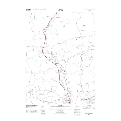
2013 Map of Cogan Station
USGS Topo · Published 2013About this map
Lycoming Cr flows southward through a narrow valley flanked by ridges, anchoring a corridor of historical settlements and small residential pockets north of Williamsport. The terrain is defined by prominent elevations such as Nail Factory Mountain and Scofield Mountain, while various hollows like Losch Hollow and Homer Hollow trace the paths of smaller tributaries. This early 21st-century landscape shows the integration of suburban growth into the rural topography, with developments like Vallamont Hills and Grampian Hills expanding near the city limits. Older rural hubs including Hepburnville, Balls Mills, and Quiggleville remain distinct, reflecting the area's long-standing agricultural and milling history. The transportation network is dominated by the highway corridor passing through Haleeka and Powys, while local aviation is represented by Finkhaven Airport near the northern boundary. Smaller community names like Fairlawn and Woodland Park suggest the mid-century infill that bridged the gap between these once-isolated rural hamlets and the urban fringe.
Find a feature on this map
211 named features on this map. Tap any name to fly to it.
Don’t see what you’re looking for? This feature index may not catch every label — zoom into the map to look around manually.
Map Details
Editions of this 2013 Cogan Station Map
This is the sole edition of this map. No revisions or reprints were ever made.
Other maps of this area

1921 · Williamsport
USGS Topo · 1:48,000

1921 · Trout Run
USGS Topo · 1:62,500

1923 · Trout Run
USGS Topo · 1:62,500

1923 · Williamsport
USGS Topo · 1:62,500

1924 · Milton
USGS Topo · 1:62,500

1930 · Warrensville
USGS Topo · 1:62,500

1934 · Warrensville
USGS Topo · 1:62,500

1944 · Trout Run
USGS Topo · 1:62,500

1944 · Williamsport
USGS Topo · 1:62,500

1953 · Warrensville
USGS Topo · 1:62,500
Featured Places
- Williamsport, PA
- Garden View, Old Lycoming Township
- Woodward Township, PA
- Lewis Township, PA
- Cogan House Township, PA