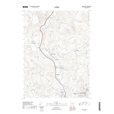
2019 Map of Cogan Station
USGS Topo · Published 2019About this map
Lycoming Creek carves a deep valley through the high ridges of central Pennsylvania, anchoring a series of small settlements and transportation corridors. Along the valley floor, the communities of Cogan Station, Hepburnville, and Powys are connected by Lycoming Creek Road, following a path between steep heights like Hogsback Mountain and Scofield Mountain. The landscape transitions from the dense northern peaks of Bobst Mountain toward the residential clusters of Garden View and Vallamont Hills on the edge of Williamsport.
Find a feature on this map
160 named features on this map. Tap any name to fly to it.
Don’t see what you’re looking for? This feature index may not catch every label — zoom into the map to look around manually.
Map Details
Editions of this 2019 Cogan Station Map
This is the sole edition of this map. No revisions or reprints were ever made.
Other maps of this area

1921 · Williamsport
USGS Topo · 1:48,000

1921 · Trout Run
USGS Topo · 1:62,500

1923 · Trout Run
USGS Topo · 1:62,500

1923 · Williamsport
USGS Topo · 1:62,500

1924 · Milton
USGS Topo · 1:62,500

1930 · Warrensville
USGS Topo · 1:62,500

1934 · Warrensville
USGS Topo · 1:62,500

1944 · Trout Run
USGS Topo · 1:62,500

1944 · Williamsport
USGS Topo · 1:62,500

1953 · Warrensville
USGS Topo · 1:62,500
Featured Places
- Williamsport, PA
- Garden View, Old Lycoming Township
- Woodward Township, PA
- Lewis Township, PA
- Cogan House Township, PA