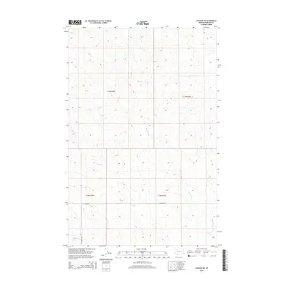
2014 Map of Cohagen NE
USGS Topo · Published 2014About this map
Skunk Arroyo and Langs Fork define the drainage patterns of this high plains landscape in Garfield County, where the terrain is marked by intricate contouring and seasonal watercourses. This 2014 survey captures a sparsely populated region of eastern Montana, where human activity is primarily traced through utility roads and township boundaries like t17n r40e and t16n r41e. The presence of Two Furrow Rd and Hay Creek Rd highlights the remote nature of the local infrastructure, serving as vital connectors across the drainages of Taylor Cr and Duck Cr. This map provides a clear record of the land division and natural water features, including L S Cr and Hay Cr, before any major modern shifts in land usage in this part of the Big Sky Country.
Find a feature on this map
12 named features on this map. Tap any name to fly to it.
Don’t see what you’re looking for? This feature index may not catch every label — zoom into the map to look around manually.
Map Details
Editions of this 2014 Cohagen NE Map
This is the sole edition of this map. No revisions or reprints were ever made.
Other maps of this area

1954 · Jordan
USGS Topo · 1:250,000

1956 · Jordan
USGS Topo · 1:250,000

1958 · Jordan
USGS Topo · 1:250,000

1964 · Jordan
USGS Topo · 1:250,000

1964 · Ada Creek
USGS Topo · 1:24,000

1964 · Black John Coulee
USGS Topo · 1:24,000

1965 · Cohagen
USGS Topo · 1:24,000

1965 · Calamity Coulee
USGS Topo · 1:24,000
1965 · York Reservoir
USGS Topo · 1:24,000

1965 · Hafla School
USGS Topo · 1:24,000