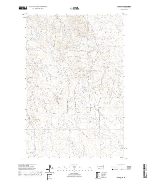
2024 Map of Cohagen NE
USGS Topo · Published 2024About this map
Garfield County’s open range is defined by a sparse network of ranch roads and winding watercourses in this high-plains landscape. The drainage of Skunk Arroyo and Duck Creek shapes the local topography, creating the natural breaks that have long dictated movement across this part of Montana. Human presence is marked primarily by foundational survey lines and a few critical transport routes like Two Furrows Rd and Hay Creek Rd, which provide access through the vast grazing lands.
Find a feature on this map
12 named features on this map. Tap any name to fly to it.
Don’t see what you’re looking for? This feature index may not catch every label — zoom into the map to look around manually.
Map Details
Editions of this 2024 Cohagen NE Map
This is the sole edition of this map. No revisions or reprints were ever made.
Other maps of this area

1954 · Jordan
USGS Topo · 1:250,000

1956 · Jordan
USGS Topo · 1:250,000

1958 · Jordan
USGS Topo · 1:250,000

1964 · Jordan
USGS Topo · 1:250,000

1964 · Ada Creek
USGS Topo · 1:24,000

1964 · Black John Coulee
USGS Topo · 1:24,000

1965 · Cohagen
USGS Topo · 1:24,000

1965 · Calamity Coulee
USGS Topo · 1:24,000
1965 · York Reservoir
USGS Topo · 1:24,000

1965 · Hafla School
USGS Topo · 1:24,000