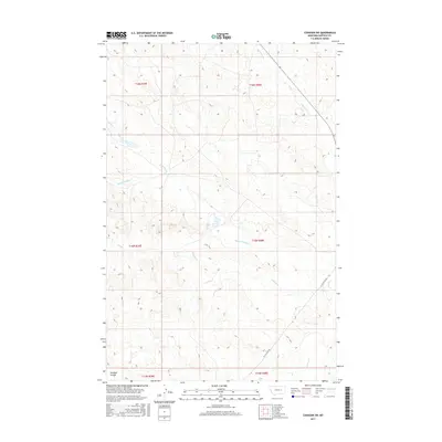
2017 Map of Cohagen SW
USGS Topo · Published 2017About this map
Knudson Coulee and the branching drainages of the Phillips Creek system define this section of Garfield County. The terrain is structured by a complex network of seasonal watercourses, including N Phillips Creek and Middle Phillips Creek, which flow through the arid landscape. The Public Land Survey System grid heavily influences the local geography, with numerous sections demarcated across townships such as t15n r40e. While predominantly undeveloped, the area is accessible via W Little Dry Rd, which skirts the southern reaches near Little Dry Creek. This 2017 survey reflects the remote ranching character of central Montana, where water management remains the primary driver of human activity and land use, as seen in the scattered small stock reservoirs and catchments that dot the drainage basins like Red Horse Creek.
Find a feature on this map
13 named features on this map. Tap any name to fly to it.
Don’t see what you’re looking for? This feature index may not catch every label — zoom into the map to look around manually.
Map Details
Editions of this 2017 Cohagen SW Map
This is the sole edition of this map. No revisions or reprints were ever made.
Other maps of this area

1954 · Jordan
USGS Topo · 1:250,000

1954 · Forsyth
USGS Topo · 1:250,000

1956 · Jordan
USGS Topo · 1:250,000

1957 · Forsyth
USGS Topo · 1:250,000

1958 · Jordan
USGS Topo · 1:250,000

1958 · Forsyth
USGS Topo · 1:250,000

1964 · Jordan
USGS Topo · 1:250,000

1965 · Black Hills
USGS Topo · 1:24,000

1965 · Cohagen
USGS Topo · 1:24,000

1965 · Kirby Ranch
USGS Topo · 1:24,000