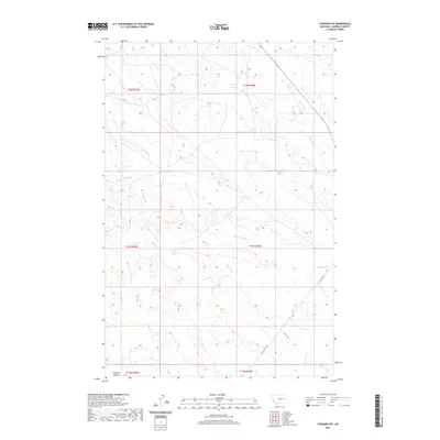
2020 Map of Cohagen SW
USGS Topo · Published 2020About this map
Red Horse Cr and the various branches of the Phillips Creek system carve a complex drainage pattern across this portion of Garfield County. This high plains landscape is defined by its intermittent waterways, including N Phillips Cr, Middle Phillips Cr, and the primary Phillips Cr, which trend generally eastward. The terrain is marked by distinct geological features like Knudson Coulee in the southwest corner. Human presence is sparse, represented primarily by the tracking of W Little Dry Rd and a few improved routes like Highway 59 cutting through the northeast. This 2020 survey illustrates the vast, open-range character of the Montana prairie, where the Public Land Survey System grids—spanning t16n r39e down to t14n r40e—provide the primary structural framework for land management and navigation in an area devoid of concentrated settlements.
Find a feature on this map
14 named features on this map. Tap any name to fly to it.
Don’t see what you’re looking for? This feature index may not catch every label — zoom into the map to look around manually.
Map Details
Editions of this 2020 Cohagen SW Map
This is the sole edition of this map. No revisions or reprints were ever made.
Other maps of this area

1954 · Jordan
USGS Topo · 1:250,000

1954 · Forsyth
USGS Topo · 1:250,000

1956 · Jordan
USGS Topo · 1:250,000

1957 · Forsyth
USGS Topo · 1:250,000

1958 · Jordan
USGS Topo · 1:250,000

1958 · Forsyth
USGS Topo · 1:250,000

1964 · Jordan
USGS Topo · 1:250,000

1965 · Black Hills
USGS Topo · 1:24,000

1965 · Cohagen
USGS Topo · 1:24,000

1965 · Kirby Ranch
USGS Topo · 1:24,000