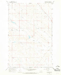
1965 Map of Cohagen SW
USGS Topo · Published 1968About this map
White Horse Creek and a network of intermittent waterways define this high plains landscape in eastern Garfield County. The drainage patterns of North Phillips Creek and Middle Phillips Creek suggest a seasonal rhythm of water management essential for ranching in this arid region. The presence of the Mincoff Ranch and the locality of Nelson represent the sparse but deliberate human settlement patterns typical of mid-century Montana rangeland.
Find a feature on this map
12 named features on this map. Tap any name to fly to it.
Don’t see what you’re looking for? This feature index may not catch every label — zoom into the map to look around manually.
Map Details
Editions of this 1965 Cohagen SW Map
This is the sole edition of this map. No revisions or reprints were ever made.
Other maps of this area

1954 · Jordan
USGS Topo · 1:250,000

1954 · Forsyth
USGS Topo · 1:250,000

1956 · Jordan
USGS Topo · 1:250,000

1957 · Forsyth
USGS Topo · 1:250,000

1958 · Jordan
USGS Topo · 1:250,000

1958 · Forsyth
USGS Topo · 1:250,000

1964 · Jordan
USGS Topo · 1:250,000

1965 · Black Hills
USGS Topo · 1:24,000

1965 · Cohagen
USGS Topo · 1:24,000

1965 · Kirby Ranch
USGS Topo · 1:24,000