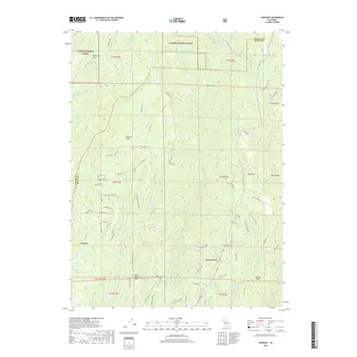
2018 Map of Cohasset
USGS Topo · Published 2018About this map
Cohasset sits atop the high ground of Cohasset Ridge in this detailed look at the interface between the Sacramento Valley foothills and the Sierra Nevada. The settlement is defined by its network of mountain roads such as Ponderosa Way and Cohasset Rd, serving as a residential hub for the timbered uplands. The landscape is deeply carved by water, with Big Chico Cr and Butte Cr defining the eastern and western reaches of the quadrangle.
Find a feature on this map
83 named features on this map. Tap any name to fly to it.
Don’t see what you’re looking for? This feature index may not catch every label — zoom into the map to look around manually.
Map Details
Editions of this 2018 Cohasset Map
This is the sole edition of this map. No revisions or reprints were ever made.
Other maps of this area

1886 · Lassen Peak
USGS Topo · 1:250,000

1891 · Chico
USGS Topo · 1:125,000

1892 · Lassen Peak
USGS Topo · 1:250,000

1893 · Chico
USGS Topo · 1:125,000

1894 · Lassen Peak
USGS Topo · 1:250,000

1895 · Chico
USGS Topo · 1:125,000

1912 · Keefers
USGS Topo · 1:31,680

1935 · Paynes Creek
USGS Topo · 1:96,000

1941 · Mineral
USGS Topo · 1:125,000

1944 · Richardson Springs
USGS Topo · 1:62,500