
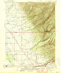
1944 Map of Richardson Springs
USGS Topo · Published 1944About this map
The foothills of the Sugarloaf Mountain and the transition into the Sacramento Valley define this 1941 survey, where the Army Flying School and U S Auxiliary Field signal the wartime mobilization of the early 1940s. The landscape is a mix of rugged volcanic ridges and the productive alluvial plains of the Bosquejo land grant. Water management is central to the area's development, evidenced by the complex network of the Keefer Slough, Mud Creek, and the Lindo Channel.
Find a feature on this map
55 named features on this map. Tap any name to fly to it.
Don’t see what you’re looking for? This feature index may not catch every label — zoom into the map to look around manually.
Map Details
Editions of this 1944 Richardson Springs Map
2 editions found
Other maps of this area

1886 · Lassen Peak
USGS Topo · 1:250,000

1890 · Red Bluff
USGS Topo · 1:250,000

1891 · Chico
USGS Topo · 1:125,000

1892 · Lassen Peak
USGS Topo · 1:250,000

1893 · Chico
USGS Topo · 1:125,000

1894 · Lassen Peak
USGS Topo · 1:250,000

1894 · Red Bluff
USGS Topo · 1:250,000

1895 · Chico
USGS Topo · 1:125,000

1904 · Vina
USGS Topo · 1:62,500

1905 · Tehama
USGS Topo · 1:62,500