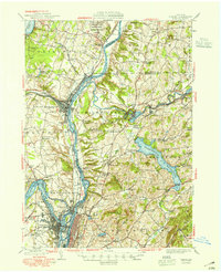
1949 Map of Cohoes
USGS Topo · Published 1949About this map
The Hudson River serves as the central artery for this industrial and historical landscape, where the confluence with the Mohawk River anchors the growing cities of Cohoes and Troy. This postwar era map captures the complex engineering of the Erie Canal and Champlain Canal systems as they navigate the region's topography alongside the Boston and Maine and New York Central railroads. To the north, the Saratoga National Historical Park preserves the grounds of Bemis Heights, providing a stark contrast to the nearby mill towns like Stillwater and Mechanicville. The eastern portion of the sheet is dominated by the sprawling Tomhannock Reservoir, which submerged earlier rural landscapes to provide water for the surrounding urban centers. Dozens of numbered schools, such as School No 9 and School No 3, remain scattered across the uplands near Rice Mtn and Mt Rafinesque, documenting the persistence of rural districts even as the river valleys industrialized.
Find a feature on this map
81 named features on this map. Tap any name to fly to it.
Don’t see what you’re looking for? This feature index may not catch every label — zoom into the map to look around manually.
Map Details
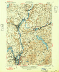
Editions of this 1949 Cohoes Map
2 editions found
Other maps of this area

1888 · Berlin
USGS Topo · 1:62,500

1890 · Berlin
USGS Topo · 1:62,500

1893 · Cohoes
USGS Topo · 1:62,500

1893 · Troy
USGS Topo · 1:62,500

1893 · Schenectady
USGS Topo · 1:62,500

1893 · Albany
USGS Topo · 1:62,500

1894 · Berlin
USGS Topo · 1:62,500

1895 · Troy
USGS Topo · 1:62,500

1895 · Cohoes
USGS Topo · 1:62,500

1895 · Albany
USGS Topo · 1:62,500