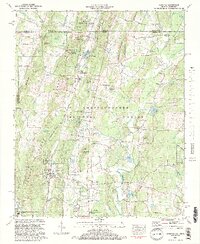
1982 Map of Cohutta
USGS Topo · Published 1984About this map
Red Clay State Historic Area sits at the very edge of the Georgia-Tennessee border, anchoring a landscape where the Southern Railway cuts through narrow gaps like Whites Cut and Masters Cut. The settlements of Cohutta and Varnell follow the rail line along the base of Cohutta Ridge, surrounded by a network of springs such as Council Spring and Varnell Spring. The presence of the National Fish Hatchery and the landmark Prater Mill reflect an economy tied to the abundant water resources found throughout the Chattahoochee National Forest. This 1980s-era survey captures the area before modern expansion, preserving the locations of rural congregations like Andrew Chapel and family burial sites including Goode Cem and Hoskins Cem. The terrain is defined by distinct north-south alignments, with Stockburger Ridge and Red Clay Ridge shaping the path of Coahulla Creek.
Find a feature on this map
84 named features on this map. Tap any name to fly to it.
Don’t see what you’re looking for? This feature index may not catch every label — zoom into the map to look around manually.
Map Details
Editions of this 1982 Cohutta Map
2 editions found
Other maps of this area

1886 · Dalton
USGS Topo · 1:125,000

1886 · Cleveland
USGS Topo · 1:125,000

1886 · Ringgold
USGS Topo · 1:125,000

1888 · Chattanooga
USGS Topo · 1:125,000

1892 · Ringgold
USGS Topo · 1:125,000

1892 · Cleveland
USGS Topo · 1:125,000

1892 · Dalton
USGS Topo · 1:125,000

1893 · Chattanooga
USGS Topo · 1:125,000

1895 · Cleveland
USGS Topo · 1:125,000

1897 · Dalton
USGS Topo · 1:125,000