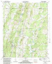
1982 Map of Cohutta
USGS Topo · Published 1984About this map
The Red Clay State Historic Area sits at the northern edge of this North Georgia landscape, marking a site of deep significance at the Tennessee and Georgia border. The 1982 topography reveals a rural network defined by the Southern railroad and the rolling elevations of Cohutta Ridge. Settlements such as Cohutta, Varnell, and Red Clay are centers of community life, supported by numerous country churches including Andrew Chapel and Hopewell Ch.
Find a feature on this map
76 named features on this map. Tap any name to fly to it.
Don’t see what you’re looking for? This feature index may not catch every label — zoom into the map to look around manually.
Map Details
Editions of this 1982 Cohutta Map
2 editions found
Other maps of this area

1886 · Dalton
USGS Topo · 1:125,000

1886 · Cleveland
USGS Topo · 1:125,000

1886 · Ringgold
USGS Topo · 1:125,000

1888 · Chattanooga
USGS Topo · 1:125,000

1892 · Ringgold
USGS Topo · 1:125,000

1892 · Cleveland
USGS Topo · 1:125,000

1892 · Dalton
USGS Topo · 1:125,000

1893 · Chattanooga
USGS Topo · 1:125,000

1895 · Cleveland
USGS Topo · 1:125,000

1897 · Dalton
USGS Topo · 1:125,000