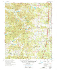
1978 Map of Coila
USGS Topo · Published 1978About this map
The Choctaw Treaty Line 1820 cuts diagonally across this landscape, marking a significant historical boundary in central Mississippi. The terrain is defined by the headwaters and branches of numerous creek systems, including Abiaca Creek, Peachahala Creek, and Fannegusha Creek, which drain a network of family-named water bodies like Costilow Lake and Barrentine Lake. Industrial and transportation corridors are prominent along the eastern edge, where the Illinois Central Gulf railroad and Interstate 55 parallel each other through Winona and Vaiden.
Find a feature on this map
72 named features on this map. Tap any name to fly to it.
Don’t see what you’re looking for? This feature index may not catch every label — zoom into the map to look around manually.
Map Details
Editions of this 1978 Coila Map
This is the sole edition of this map. No revisions or reprints were ever made.
Other maps of this area

1936 · Greenwood
USGS Topo · 1:62,500

1940 · Seven Pines
USGS Topo · 1:62,500

1940 · Lexington
USGS Topo · 1:62,500

1940 · Greenwood
USGS Topo · 1:62,500

1953 · Greenwood
USGS Topo · 1:250,000

1953 · West Point
USGS Topo · 1:250,000

1954 · Duck Hill
USGS Topo · 1:62,500

1954 · McCarley
USGS Topo · 1:62,500

1956 · Greenwood
USGS Topo · 1:250,000

1957 · Greenwood
USGS Topo · 1:62,500