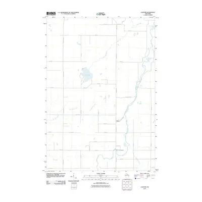
2010 Map of Colburn
USGS Topo · Published 2010About this map
The Yellow River flows southward through this rural section of Chippewa County, providing the primary drainage for a landscape defined by its many tributary systems. The settlement of Colburn is situated at the junction of County Hwy-S and County Hwy-D, serving as a central point for the surrounding agricultural community. To the northwest, Pike Lake is a prominent natural feature, fed by Pike Creek as it moves toward its confluence with the larger river system.
Find a feature on this map
38 named features on this map. Tap any name to fly to it.
Don’t see what you’re looking for? This feature index may not catch every label — zoom into the map to look around manually.
Map Details
Editions of this 2010 Colburn Map
This is the sole edition of this map. No revisions or reprints were ever made.
Other maps of this area

1951 · Cornell
USGS Topo · 1:62,500

1951 · Gilman
USGS Topo · 1:62,500

1952 · Cadott
USGS Topo · 1:62,500

1952 · Stanley
USGS Topo · 1:62,500

1953 · Eau Claire
USGS Topo · 1:250,000

1953 · Rice Lake
USGS Topo · 1:250,000

1958 · Eau Claire
USGS Topo · 1:250,000

1959 · Rice Lake
USGS Topo · 1:250,000

1964 · Eau Claire
USGS Topo · 1:250,000
1973 · Colburn
USGS Topo · 1:24,000