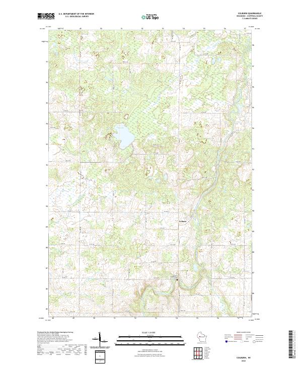
2022 Map of Colburn
USGS Topo · Published 2022About this map
The Yellow River winds through the heart of this Chippewa County landscape, anchoring a network of small streams and wetlands. The settlement of Colburn sits at the junction of Co Hwy D and Co Hwy S, serving as a focal point for the surrounding rural area. To the south, the Walker Jackson Cem provides a significant touchstone for genealogical research, situated near the confluence of Chap Cr and the river.
Find a feature on this map
47 named features on this map. Tap any name to fly to it.
Don’t see what you’re looking for? This feature index may not catch every label — zoom into the map to look around manually.
Map Details
Editions of this 2022 Colburn Map
This is the sole edition of this map. No revisions or reprints were ever made.
Other maps of this area

1951 · Cornell
USGS Topo · 1:62,500

1951 · Gilman
USGS Topo · 1:62,500

1952 · Cadott
USGS Topo · 1:62,500

1952 · Stanley
USGS Topo · 1:62,500

1953 · Eau Claire
USGS Topo · 1:250,000

1953 · Rice Lake
USGS Topo · 1:250,000

1958 · Eau Claire
USGS Topo · 1:250,000

1959 · Rice Lake
USGS Topo · 1:250,000

1964 · Eau Claire
USGS Topo · 1:250,000
1973 · Colburn
USGS Topo · 1:24,000