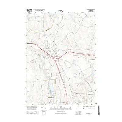
2015 Map of Colchester
USGS Topo · Published 2015About this map
Colchester serves as the central hub of this southeastern Connecticut landscape, where historic settlement patterns meet modern conservation. The town center is densely documented, featuring the Old Burying Ground and Linwood Cem, alongside the local Po. To the north, the community of Amston borders the sizable Amston Lake, while the southern portion of the map is dominated by the recreational and residential clusters around Lake Hayward and the village of Haywardville.
Find a feature on this map
173 named features on this map. Tap any name to fly to it.
Don’t see what you’re looking for? This feature index may not catch every label — zoom into the map to look around manually.
Map Details
Editions of this 2015 Colchester Map
This is the sole edition of this map. No revisions or reprints were ever made.
Other maps of this area

1892 · New London
USGS Topo · 1:62,500

1892 · Norwich
USGS Topo · 1:62,500

1892 · Gilead
USGS Topo · 1:62,500

1893 · New London
USGS Topo · 1:62,500

1893 · Saybrook
USGS Topo · 1:62,500

1921 · New London
USGS Topo · 1:62,500

1935 · Montville
USGS Topo · 1:24,000

1939 · Montville
USGS Topo · 1:31,680

1943 · Fitchville
USGS Topo · 1:31,680

1944 · Marlboro
USGS Topo · 1:31,680