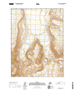
2020 Map of Cold Bay B-1 NE
USGS Topo · Published 2020About this map
Cathedral River defines the central geography of this high-latitude Alaskan landscape, carving a primary drainage path through the deep corridor of Cathedral Valley. The topographical data, derived from the U.S. Geological Survey in coordination with the National Elevation Dataset, illustrates a wilderness largely defined by its glacial and fluvial morphology rather than human infrastructure. The absence of roads, buildings, or named settlements highlights the remote character of the Aleutians East Borough, where the terrain transitions from steep ridges down to the braided channel of the river. This survey provides a precise record of the natural landforms and township boundaries including t54s r84w and t55s r83w in the years following the turn of the twenty-first century.
Find a feature on this map
6 named features on this map. Tap any name to fly to it.
Don’t see what you’re looking for? This feature index may not catch every label — zoom into the map to look around manually.
Map Details
Editions of this 2020 Cold Bay B-1 NE Map
This is the sole edition of this map. No revisions or reprints were ever made.
Other maps of this area

1943 · Fort Randall
USGS Topo · 1:250,000

1949 · Fort Randall
USGS Topo · 1:250,000

1950 · Fort Randall
USGS Topo · 1:250,000

1953 · Port Moller
USGS Topo · 1:250,000

1963 · Port Moller C-6
USGS Topo · 1:63,360
1963 · Cold Bay C-1
USGS Topo · 1:63,360

1983 · Port Moller B-6
USGS Topo · 1:63,360
1983 · Cold Bay B-1
USGS Topo · 1:63,360

1988 · Port Moller
USGS Topo · 1:250,000
2020 · Cold Bay B-1 NW
USGS Topo · 1:25,000