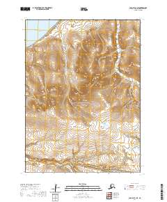
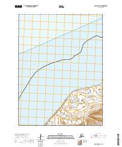
2020 Map of Cold Bay C-1 NE
USGS Topo · Published 2020About this map
Bering Sea waters wash against the northwestern coastline of the Alaska Peninsula in this survey of the Black Hills. This region of the Aleutians East Borough is characterized by dramatic topographic relief, where the peaks of the hills rise sharply from the coast. The absence of roads or established settlements emphasizes the remote nature of this wilderness, which is defined by its natural topography rather than human infrastructure. The map detail provides a clear view of the drainage patterns from the Black Hill heights toward the sea, offering an unvarnished look at the coastal geography as it existed in 2020.
Find a feature on this map
8 named features on this map. Tap any name to fly to it.
Don’t see what you’re looking for? This feature index may not catch every label — zoom into the map to look around manually.
Map Details
Editions of this 2020 Cold Bay C-1 NE Map
This is the sole edition of this map. No revisions or reprints were ever made.
Other maps of this area

1943 · Fort Randall
USGS Topo · 1:250,000

1949 · Fort Randall
USGS Topo · 1:250,000

1950 · Fort Randall
USGS Topo · 1:250,000

1953 · Port Moller
USGS Topo · 1:250,000

1963 · Port Moller C-6
USGS Topo · 1:63,360
1963 · Port Moller D-6
USGS Topo · 1:63,360
1963 · Cold Bay D-1
USGS Topo · 1:63,360
1963 · Cold Bay C-1
USGS Topo · 1:63,360

1988 · Port Moller
USGS Topo · 1:250,000
2020 · Cold Bay D-1 SE
USGS Topo · 1:25,000