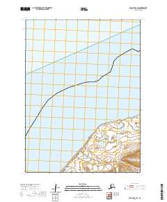
2020 Map of Cold Bay D-1 SE
USGS Topo · Published 2020About this map
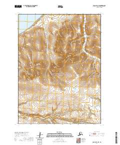
Alaska Peninsula terrain meets the coastal waters of Bristol Bay in this 2020 topographic record of the Aleutians East region. The landscape is defined by the prominent landform of Cape Lieskof, where the shoreline curves along the western edge of the peninsula. Surveyed by the U.S. Geological Survey using data from the National Hydrography Dataset and National Elevation Dataset, the map illustrates the complex interface between the coastline and the interior. The cartography includes detailed public land survey system boundaries, such as t51s r83w and t51s r82w, which provide a framework for understanding land divisions in this maritime environment. This modern survey captures the elevation contours and wetland characteristics of the peninsula's tip before it extends further into the Bering Sea.
Find a feature on this map
7 named features on this map. Tap any name to fly to it.
Don’t see what you’re looking for? This feature index may not catch every label — zoom into the map to look around manually.
Map Details
Editions of this 2020 Cold Bay D-1 SE Map
This is the sole edition of this map. No revisions or reprints were ever made.
Other maps of this area

1943 · Fort Randall
USGS Topo · 1:250,000

1949 · Fort Randall
USGS Topo · 1:250,000

1950 · Fort Randall
USGS Topo · 1:250,000

1953 · Port Moller
USGS Topo · 1:250,000

1963 · Port Moller C-6
USGS Topo · 1:63,360
1963 · Port Moller D-6
USGS Topo · 1:63,360
1963 · Cold Bay D-1
USGS Topo · 1:63,360
1963 · Cold Bay C-1
USGS Topo · 1:63,360

1988 · Port Moller
USGS Topo · 1:250,000
2020 · Cold Bay C-1 NE
USGS Topo · 1:25,000