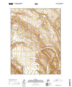
2020 Map of Cold Bay C-1 SE
USGS Topo · Published 2020About this map
Alaska Peninsula terrain dominates this 2020 survey, where the glacial and volcanic history of the region is etched into the landscape. The topographic data reveals the dramatic drainage patterns of the Cathedral River, which carves through the southwestern portion of the map. This waterway is framed by the steep rising elevations of Cathedral Valley, a primary geographic feature that dictates the local hydrology. Unlike maps of more settled areas, this quadrangle highlights a wilderness defined by its natural contours and the absence of established road networks or permanent human settlements. The survey provides a precise record of the shoreline and interior mountain structures as they existed in the early 21st century, serving as an essential reference for understanding the shifting environmental conditions of the Aleutian region.
Find a feature on this map
7 named features on this map. Tap any name to fly to it.
Don’t see what you’re looking for? This feature index may not catch every label — zoom into the map to look around manually.
Map Details
Editions of this 2020 Cold Bay C-1 SE Map
This is the sole edition of this map. No revisions or reprints were ever made.
Other maps of this area

1943 · Fort Randall
USGS Topo · 1:250,000

1949 · Fort Randall
USGS Topo · 1:250,000

1950 · Fort Randall
USGS Topo · 1:250,000

1953 · Port Moller
USGS Topo · 1:250,000

1963 · Port Moller C-6
USGS Topo · 1:63,360
1963 · Cold Bay C-1
USGS Topo · 1:63,360

1983 · Port Moller B-6
USGS Topo · 1:63,360
1983 · Cold Bay B-1
USGS Topo · 1:63,360

1988 · Port Moller
USGS Topo · 1:250,000
2020 · Cold Bay C-1 NE
USGS Topo · 1:25,000