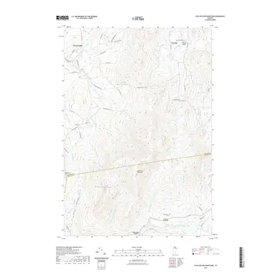
2021 Map of Cold Hollow Mountains
USGS Topo · Published 2021About this map
Cold Hollow Mountains define this high-elevation corridor of Northern Vermont, where the topography transitions between the Franklin and Lamoille county lines. The landscape is characterized by steep ridges and a dense network of mountain streams, including Tyler Branch and Cold Hollow Brook, which flow through narrow valleys toward the larger North Branch Lamoille River in the south. The settlement of Belvidere Center sits at the base of these heights, while smaller clusters like West Hill occupy the upland benches. Local history is anchored by sites such as the West Hill Covered Bridge and several family or community burial grounds, including Cook Cem and Chamberlain Cem. The presence of roads like Sacketts Harbor Rd and Old Gibou Rd indicates a rural transport network adapted to the challenging terrain of the Green Mountains range.
Find a feature on this map
53 named features on this map. Tap any name to fly to it.
Don’t see what you’re looking for? This feature index may not catch every label — zoom into the map to look around manually.
Map Details
Editions of this 2021 Cold Hollow Mountains Map
This is the sole edition of this map. No revisions or reprints were ever made.
Other maps of this area

1919 · Montgomery
USGS Topo · 1:62,500

1920 · Franklin Pond
USGS Topo · 1:62,500

1920 · Montgomery
USGS Topo · 1:62,500

1922 · Enosburg Falls
USGS Topo · 1:48,000

1924 · Enosburg Falls
USGS Topo · 1:62,500

1925 · Jay Peak
USGS Topo · 1:62,500

1925 · Mount Mansfield
USGS Topo · 1:48,000

1927 · Mount Mansfield
USGS Topo · 1:62,500

1927 · Hyde Park
USGS Topo · 1:48,000

1930 · Hyde Park
USGS Topo · 1:62,500