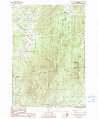
1986 Map of Cold Hollow Mountains
USGS Topo · Published 1987About this map
Cold Hollow Mountains dominate this mid-1980s landscape, forming a prominent spine between the townships of Enosburg, Montgomery, and Bakersfield. The terrain is defined by a dense network of high-elevation drainages including Cold Hollow Brook and the North Fork, which feed into the Tyler Branch and eventually the Lamoille River in the south. Settlement is largely confined to the lower elevations at the quadrangle's margins, notably at East Enosburg in the northwest and Belvidere Center in the south.
Find a feature on this map
29 named features on this map. Tap any name to fly to it.
Don’t see what you’re looking for? This feature index may not catch every label — zoom into the map to look around manually.
Map Details
Editions of this 1986 Cold Hollow Mountains Map
This is the sole edition of this map. No revisions or reprints were ever made.
Other maps of this area

1919 · Montgomery
USGS Topo · 1:62,500

1920 · Franklin Pond
USGS Topo · 1:62,500

1920 · Montgomery
USGS Topo · 1:62,500

1922 · Enosburg Falls
USGS Topo · 1:48,000

1924 · Enosburg Falls
USGS Topo · 1:62,500

1925 · Jay Peak
USGS Topo · 1:62,500

1925 · Mount Mansfield
USGS Topo · 1:48,000

1927 · Mount Mansfield
USGS Topo · 1:62,500

1927 · Hyde Park
USGS Topo · 1:48,000

1930 · Hyde Park
USGS Topo · 1:62,500