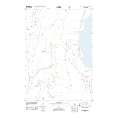
2011 Map of Cold Spring Ridge
USGS Topo · Published 2011About this map
Cold Spring Ridge and Indian Mountain dominate this part of the Idaho landscape, where the Little Weiser River winds through a network of drainages and named basins. The nomenclature of the area suggests a history of cattle ranching and early travel, with landmarks such as Scott Corral, Burnt Wagon Basin, and the curiously named Beer Bottle Crossing.
Find a feature on this map
27 named features on this map. Tap any name to fly to it.
Don’t see what you’re looking for? This feature index may not catch every label — zoom into the map to look around manually.
Map Details
Editions of this 2011 Cold Spring Ridge Map
This is the sole edition of this map. No revisions or reprints were ever made.
Other maps of this area

1894 · Squaw Creek
USGS Topo · 1:125,000

1911 · Meadows
USGS Topo · 1:125,000

1953 · Smiths Ferry
USGS Topo · 1:62,500

1954 · Council
USGS Topo · 1:62,500

1954 · Cascade
USGS Topo · 1:62,500

1955 · Baker
USGS Topo · 1:250,000

1959 · Baker
USGS Topo · 1:250,000
1970 · Twin Sisters
USGS Topo · 1:24,000

1980 · McCall
USGS Topo · 1:100,000

1980 · Weiser
USGS Topo · 1:100,000