
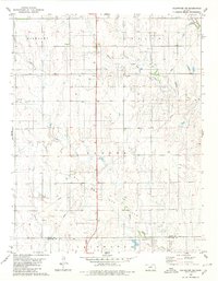
1979 Map of Coldwater
USGS Topo · Published 1980About this map
The town of Coldwater serves as the focal point of this Comanche County survey, showcasing a classic Great Plains grid layout at the intersection of local industry and transport. The infrastructure of the town is detailed with a Hospital, a Radio Tower, and the High Sch, while the Atchison Topeka and Santa Fe railroad line cuts diagonally across the prairie to the northeast. This transportation corridor was vital for the region's agricultural and industrial exports, including resources from the nearby Oil and Gas Field and local excavations like the Gravel Pit.
Find a feature on this map
18 named features on this map. Tap any name to fly to it.
Don’t see what you’re looking for? This feature index may not catch every label — zoom into the map to look around manually.
Map Details
Editions of this 1979 Coldwater Map
This is the sole edition of this map. No revisions or reprints were ever made.
Other maps of this area

1892 · Coldwater
USGS Topo · 1:125,000

1955 · Pratt
USGS Topo · 1:250,000

1959 · Pratt
USGS Topo · 1:250,000

1979 · East Kiowa Creek South
USGS Topo · 1:24,000
1979 · East Kiowa Creek North
USGS Topo · 1:24,000

1979 · Protection NE
USGS Topo · 1:24,000
1980 · Nescatunga Creek North
USGS Topo · 1:24,000
1980 · Protection
USGS Topo · 1:24,000
1980 · Wilmore
USGS Topo · 1:24,000
1980 · Coldwater NE
USGS Topo · 1:24,000