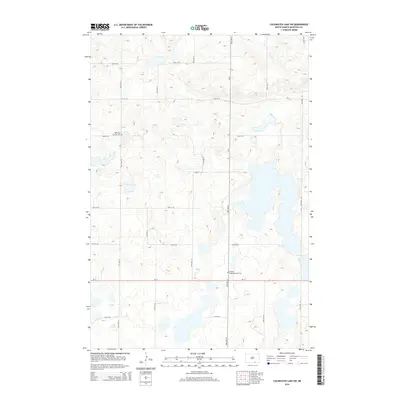
2014 Map of Coldwater Lake SW
USGS Topo · Published 2014About this map
Glacial depressions and prairie wetlands characterize this section of McIntosh County, where the high-plains landscape is divided by a rigid grid of section-line roads. ND-11 serves as the primary east-west corridor across the southern portion of the map, while CR-9 provides a northern route through the interior. For those researching the German-Russian heritage of the region, the presence of the Hoffnungs German Cem and the Friedens Congregational Cem offers concrete links to early 20th-century settlement patterns and community centers that once dotted these grasslands. The terrain is notably sparse, defined by small unnamed lakes and sloughs that disrupt the otherwise uniform agricultural grid of routes like 92nd St SE and 58th Ave SE.
Find a feature on this map
19 named features on this map. Tap any name to fly to it.
Don’t see what you’re looking for? This feature index may not catch every label — zoom into the map to look around manually.
Map Details
Editions of this 2014 Coldwater Lake SW Map
This is the sole edition of this map. No revisions or reprints were ever made.
Other maps of this area

1953 · Jamestown
USGS Topo · 1:250,000

1954 · Aberdeen
USGS Topo · 1:250,000

1956 · Aberdeen
USGS Topo · 1:250,000

1956 · Jamestown
USGS Topo · 1:250,000

1968 · Long Lake NW
USGS Topo · 1:24,000

1968 · Long Lake NE
USGS Topo · 1:24,000

1978 · Schumacher Lake NE
USGS Topo · 1:24,000

1982 · Coldwater Lake NW
USGS Topo · 1:24,000

1982 · Coldwater Lake NE
USGS Topo · 1:24,000

1982 · Ashley East
USGS Topo · 1:24,000