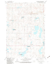
1982 Map of Coldwater Lake SW
USGS Topo · Published 1983About this map
Glacial prairie potholes and protected wetlands define this portion of McIntosh County, surveyed during the late 1970s. The landscape is heavily marked by numerous National Waterfowl Production Area designations, reflecting a dedicated conservation effort across the township lines. Cultural history is anchored by the Friedens Congregational Church and its associated Friedens Congregational Cem, alongside the Hoffnungs German Cem, which serve as vital markers of the area's German-Russian settlement heritage. Human activity in this rural stretch is further evidenced by the Nitschke Landing Strip and the expansive waters of Coldwater Lake along the eastern margin. The map provides a precise view of the section lines and unimproved roads that connected these isolated farmsteads and religious centers before modern consolidation.
Find a feature on this map
9 named features on this map. Tap any name to fly to it.
Don’t see what you’re looking for? This feature index may not catch every label — zoom into the map to look around manually.
Map Details
Editions of this 1982 Coldwater Lake SW Map
This is the sole edition of this map. No revisions or reprints were ever made.
Other maps of this area

1953 · Jamestown
USGS Topo · 1:250,000

1954 · Aberdeen
USGS Topo · 1:250,000

1956 · Aberdeen
USGS Topo · 1:250,000

1956 · Jamestown
USGS Topo · 1:250,000

1968 · Long Lake NW
USGS Topo · 1:24,000

1968 · Long Lake NE
USGS Topo · 1:24,000

1978 · Schumacher Lake NE
USGS Topo · 1:24,000

1982 · Coldwater Lake NW
USGS Topo · 1:24,000

1982 · Coldwater Lake NE
USGS Topo · 1:24,000

1982 · Ashley East
USGS Topo · 1:24,000