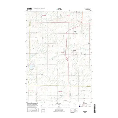
2015 Map of Coleman
USGS Topo · Published 2015About this map
The Little Peshtigo River and the S Br Beaver Cr define the hydrological landscape of central Marinette County in this 2015 survey. The interconnected settlements of Beaver, Pound, and Coleman align along the north-south transportation corridor, illustrating the region's agricultural and transit-oriented development. While much of the terrain is marked by wetland systems and small tributaries like Whisky Cr and Murphy Cr, the map also documents localized aviation and community history at the Ermis-Ridgeview Airport. Local genealogists will find significant value in the documentation of regional burial grounds, including Saint Leos Cem near Pound and Saint Johns Cem and Trinity Cem further south. The boundary between Marinette and Oconto counties is clearly delineated near Montana Lake and Jones Lake, providing a clear reference for property research and municipal history in this part of Wisconsin.
Find a feature on this map
80 named features on this map. Tap any name to fly to it.
Don’t see what you’re looking for? This feature index may not catch every label — zoom into the map to look around manually.
Map Details
Editions of this 2015 Coleman Map
This is the sole edition of this map. No revisions or reprints were ever made.
Other maps of this area

1939 · Porterfield
USGS Topo · 1:48,000

1941 · Coleman
USGS Topo · 1:48,000

1942 · Coleman
USGS Topo · 1:48,000

1942 · Porterfield
USGS Topo · 1:48,000

1950 · Coleman
USGS Topo · 1:48,000

1954 · Iron Mountain
USGS Topo · 1:250,000

1954 · Escanaba
USGS Topo · 1:250,000

1954 · Manitowoc
USGS Topo · 1:250,000

1955 · Green Bay
USGS Topo · 1:250,000

1956 · Oconto
USGS Topo · 1:62,500