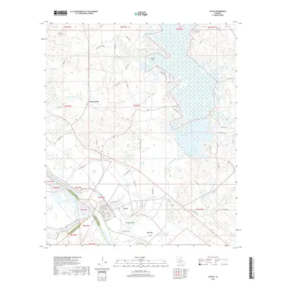
2018 Map of Colfax
USGS Topo · Published 2018About this map
Colfax serves as the focal point of this Grant Parish landscape, situated where the Red River and Cane River converge. The town's grid is clearly delineated, extending from South St to North and bordered by the Sugarhouse Bayou to the north. This area is characterized by a complex network of waterways and low-lying land, including Apalachie Island and the sprawling expanse of Lake Iatt to the northeast. To the north, the small settlement of Summerfield and landmarks like Shady Grove Cem point to the rural residential patterns of the region. The map also reveals the industrial and agricultural infrastructure of the parish, with labels for the Control House and numerous cutoff roads like Johnny Jones Cutoff and Lemoine Cutoff Rd that negotiate the shifting riparian terrain.
Find a feature on this map
89 named features on this map. Tap any name to fly to it.
Don’t see what you’re looking for? This feature index may not catch every label — zoom into the map to look around manually.
Map Details
Editions of this 2018 Colfax Map
This is the sole edition of this map. No revisions or reprints were ever made.
Other maps of this area

1932 · Colfax NE
USGS Topo · 1:31,680

1932 · Boyce NE
USGS Topo · 1:31,680

1932 · Colfax SW
USGS Topo · 1:31,680

1932 · Colfax SE
USGS Topo · 1:31,680

1932 · Colfax NW
USGS Topo · 1:31,680

1935 · Verda
USGS Topo · 1:31,680

1936 · Colfax
USGS Topo · 1:62,500

1937 · Chopin NE
USGS Topo · 1:31,680

1937 · Aloha
USGS Topo · 1:31,680

1937 · Montgomery
USGS Topo · 1:62,500