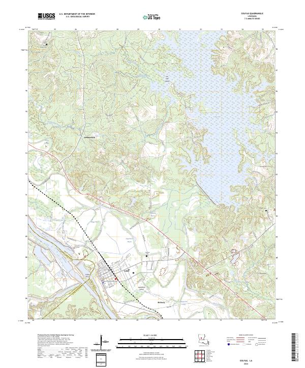
2024 Map of Colfax
USGS Topo · Published 2024About this map
The Grant Parish Courthouse stands as the central landmark of the river town of Colfax, situated near the convergence of Grant Parish, Natchitoches Parish, and Rapides Parish. This landscape is defined by the complex hydrography of the Red River valley, where the Red River itself and the Cane River wind through the western portion of the map. To the east, the expansive waters of Lake Iatt dominate the terrain, featuring distinctive landforms like Pin Oak Island and Sunken Island.
Find a feature on this map
89 named features on this map. Tap any name to fly to it.
Don’t see what you’re looking for? This feature index may not catch every label — zoom into the map to look around manually.
Map Details
Editions of this 2024 Colfax Map
This is the sole edition of this map. No revisions or reprints were ever made.
Other maps of this area

1932 · Colfax NE
USGS Topo · 1:31,680

1932 · Boyce NE
USGS Topo · 1:31,680

1932 · Colfax SW
USGS Topo · 1:31,680

1932 · Colfax SE
USGS Topo · 1:31,680

1932 · Colfax NW
USGS Topo · 1:31,680

1935 · Verda
USGS Topo · 1:31,680

1936 · Colfax
USGS Topo · 1:62,500

1937 · Chopin NE
USGS Topo · 1:31,680

1937 · Aloha
USGS Topo · 1:31,680

1937 · Montgomery
USGS Topo · 1:62,500