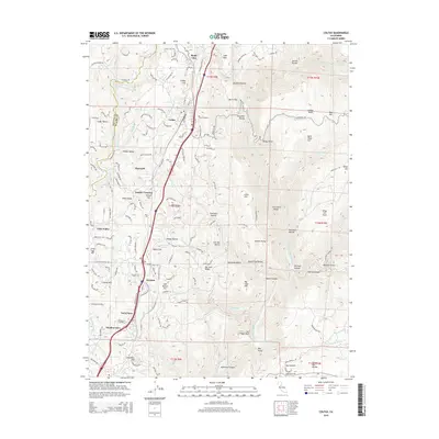
2015 Map of Colfax
USGS Topo · Published 2015About this map
Colfax serves as the central hub of this Placer County landscape, where the Sierra Nevada foothills meet the steep canyons of the North Fork American River. The map illustrates a dense network of residential clusters and historical landmarks, including Colfax Cemetery and the industrial footprint of the Hosier Mine. Moving south along the transportation corridor, settlements such as Weimar, Lander Crossing, and Heather Glen are established along the ridges overlooking the deep ravines. The topography is defined by sharp elevation changes, notably at Cape Horn and Windy Point, which drop away into Secret Ravine and Slaughter Ravine. This survey details the complex water management infrastructure of the region, featuring the Bear River Canal and numerous tributaries like Brushy Creek and Codfish Creek that feed into the larger river systems carving through the Iowa Hill Divide.
Find a feature on this map
172 named features on this map. Tap any name to fly to it.
Don’t see what you’re looking for? This feature index may not catch every label — zoom into the map to look around manually.
Map Details
Editions of this 2015 Colfax Map
This is the sole edition of this map. No revisions or reprints were ever made.
Other maps of this area

1888 · Smartsville
USGS Topo · 1:125,000

1891 · Sacramento
USGS Topo · 1:125,000

1891 · Colfax
USGS Topo · 1:125,000

1891 · Smartsville
USGS Topo · 1:125,000

1891 · Placerville
USGS Topo · 1:125,000

1892 · Sacramento
USGS Topo · 1:125,000

1892 · Placerville
USGS Topo · 1:125,000

1892 · Smartsville
USGS Topo · 1:125,000

1892 · Colfax
USGS Topo · 1:125,000

1893 · Placerville
USGS Topo · 1:125,000