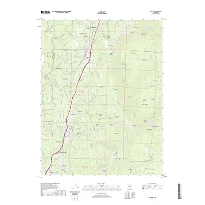
2018 Map of Colfax
USGS Topo · Published 2018About this map
Colfax serves as the central hub in this Placer County landscape, where the Sierra Nevada foothills meet a complex network of ravines and ridges. The town is flanked by historic sites like the Colfax Cem and geographic markers such as Colfax Hill and the distinctive Cape Horn bend. To the south, the terrain descends toward the North Fork American River, which carves a deep canyon through landmarks like Big Bend and Sore Finger Point. The transportation corridor is well-defined, linking Shady Glen in the north through Weimar and Heather Glen to Applegate in the south.
Find a feature on this map
72 named features on this map. Tap any name to fly to it.
Don’t see what you’re looking for? This feature index may not catch every label — zoom into the map to look around manually.
Map Details
Editions of this 2018 Colfax Map
This is the sole edition of this map. No revisions or reprints were ever made.
Other maps of this area

1888 · Smartsville
USGS Topo · 1:125,000

1891 · Sacramento
USGS Topo · 1:125,000

1891 · Colfax
USGS Topo · 1:125,000

1891 · Smartsville
USGS Topo · 1:125,000

1891 · Placerville
USGS Topo · 1:125,000

1892 · Sacramento
USGS Topo · 1:125,000

1892 · Placerville
USGS Topo · 1:125,000

1892 · Smartsville
USGS Topo · 1:125,000

1892 · Colfax
USGS Topo · 1:125,000

1893 · Placerville
USGS Topo · 1:125,000