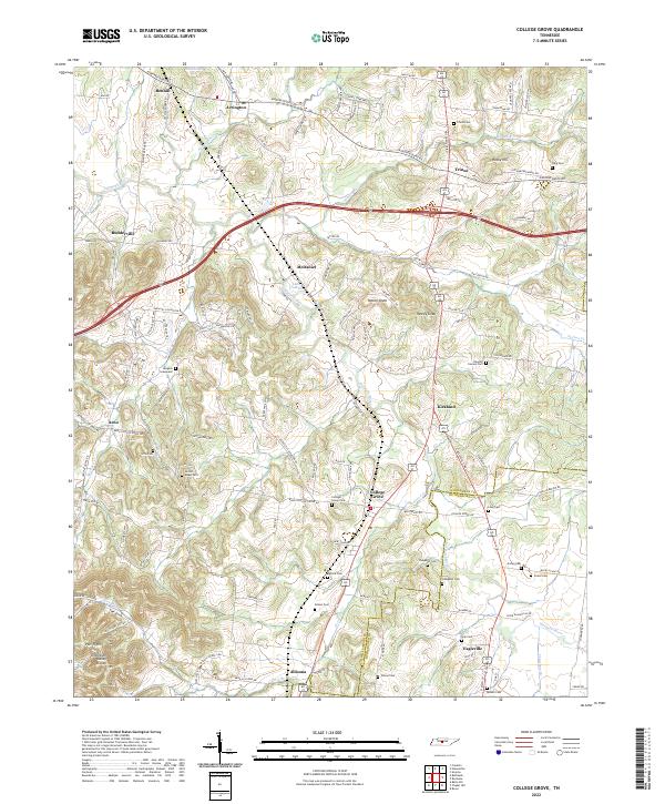
2022 Map of College Grove
USGS Topo · Published 2022About this map
The Harpeth River meanders through this portion of Williamson County, where the topography transitions toward the Tennessee Valley Divide and the Duck River Ridge. Small rural settlements like College Grove, Arrington, and Triune anchor the landscape, connected by historic routes such as Murfreesboro Rd and Nolensville Rd. The area is notably dense with small family and community burial grounds, including the Newton Cannon Cem, Ogilvie Cem, and the Burgess Graveyard, which offer significant value for genealogical research in this part of Middle Tennessee. To the southwest, the curiously named Pull Tight sits near The Cove, while prominent elevations like Patton Knob and Yancey Knob provide distinct landmarks above the river valley. The map documents the persistent agricultural character and scattered residential growth along traditional pike roads.
Find a feature on this map
127 named features on this map. Tap any name to fly to it.
Don’t see what you’re looking for? This feature index may not catch every label — zoom into the map to look around manually.
Map Details
Editions of this 2022 College Grove Map
This is the sole edition of this map. No revisions or reprints were ever made.
Other maps of this area

1909 · Franklin
USGS Topo · 1:62,500

1936 · Chapel Hill
USGS Topo · 1:24,000

1936 · Rover
USGS Topo · 1:24,000

1936 · Rally Hill
USGS Topo · 1:24,000

1936 · Bethesda
USGS Topo · 1:24,000

1942 · Lebanon
USGS Topo · 1:100,000

1944 · Shelbyville
USGS Topo · 1:100,000

1946 · Bethesda
USGS Topo · 1:24,000
1947 · Rally Hill
USGS Topo · 1:24,000

1949 · Franklin
USGS Topo · 1:24,000