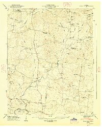
1947 Map of Rally Hill
USGS Topo · Published 1948About this map
The Tennessee Valley Authority and USGS mapped this intersection of Maury, Williamson, and Marshall counties just after World War II, revealing a landscape defined by small rural hubs and an extensive network of family cemeteries. The Lewisburg and Franklin Pike serves as a primary north-south artery, connecting the settlement at Rally Hill with neighboring Pottsville and Lees Corner. The map's high concentration of burial sites, such as Shires Cem and Riley-Harper Cem, alongside rural landmarks like Old Lasea Ch and New Bethel Ch, provides a clear view of the area's social fabric.
Find a feature on this map
86 named features on this map. Tap any name to fly to it.
Don’t see what you’re looking for? This feature index may not catch every label — zoom into the map to look around manually.
Map Details
Editions of this 1947 Rally Hill Map
4 editions found
Other maps of this area

1909 · Franklin
USGS Topo · 1:62,500

1936 · Chapel Hill
USGS Topo · 1:24,000

1936 · Farmington
USGS Topo · 1:24,000

1936 · Verona
USGS Topo · 1:24,000

1936 · Rally Hill
USGS Topo · 1:24,000

1936 · Spring Hill
USGS Topo · 1:24,000

1936 · Carters Creek
USGS Topo · 1:24,000

1936 · Glendale
USGS Topo · 1:24,000

1936 · Bethesda
USGS Topo · 1:24,000

1941 · Carters Creek
USGS Topo · 1:24,000