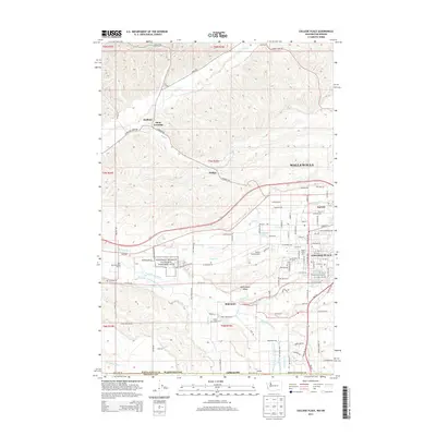
2013 Map of College Place
USGS Topo · Published 2013About this map
Whitman Mission National Historic Site sits along the southern bank of the Walla Walla River in this detailed 2013 survey of the border region between Washington and Oregon. The map centers on the growth of College Place, home to Walla Walla Univ, and its proximity to the larger urban area of Walla Walla. The landscape reveals a complex network of irrigation and natural drainage, including the Whitman Ditch, Burlingame Ditch, and Garrison Cr. To the north, the terrain transitions into the agricultural uplands of the Walla Walla Valley, where small rail and road stops like Pedigo and Sudbury mark the transit routes through the hills. This map is particularly valuable for documenting modern land use alongside historical markers like the Mt Hope Cem and the small settlement of Garrett.
Find a feature on this map
119 named features on this map. Tap any name to fly to it.
Don’t see what you’re looking for? This feature index may not catch every label — zoom into the map to look around manually.
Map Details
Editions of this 2013 College Place Map
This is the sole edition of this map. No revisions or reprints were ever made.
Other maps of this area

1915 · Wallulah
USGS Topo · 1:96,000

1918 · Wallula
USGS Topo · 1:125,000

1919 · Walla Walla
USGS Topo · 1:125,000

1921 · Walla Walla
USGS Topo · 1:125,000

1935 · Pendleton
USGS Topo · 1:125,000

1953 · Pendleton
USGS Topo · 1:250,000

1953 · Walla Walla
USGS Topo · 1:250,000

1956 · Pendleton
USGS Topo · 1:250,000

1958 · Walla Walla
USGS Topo · 1:250,000

1964 · Milton-Freewater
USGS Topo · 1:24,000