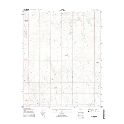
2013 Map of Collier Draw
USGS Topo · Published 2013About this map
Bernalillito Mesa and the plateau of Mesa Cortada dominate the northern landscape of this Sandoval County terrain, where water management is defined by an intricate network of tanks and seasonal washes. The arid environment is punctuated by La Jara Lake and Armijo Lake, alongside numerous livestock tanks such as Emperado Tank, Los Pasos Tank, and Old Sandy Tank. These features suggest a reliance on collected surface water for ranching in an area otherwise characterized by deep drainage systems like Collier Draw and Armijo Draw.
Find a feature on this map
34 named features on this map. Tap any name to fly to it.
Don’t see what you’re looking for? This feature index may not catch every label — zoom into the map to look around manually.
Map Details
Editions of this 2013 Collier Draw Map
This is the sole edition of this map. No revisions or reprints were ever made.
Other maps of this area

1883 · Mt. Taylor
USGS Topo · 1:250,000

1886 · Mt. Taylor
USGS Topo · 1:250,000

1888 · Bernalillo
USGS Topo · 1:125,000

1889 · Albuquerque
USGS Topo · 1:125,000

1890 · Jemes
USGS Topo · 1:125,000

1892 · Jemes
USGS Topo · 1:125,000

1892 · Mt. Taylor
USGS Topo · 1:250,000

1893 · Albuquerque
USGS Topo · 1:125,000

1899 · Mt. Taylor
USGS Topo · 1:250,000

1939 · San Ysidro
USGS Topo · 1:62,500