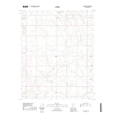
2020 Map of Collier Draw
USGS Topo · Published 2020About this map
Armijo Draw and Collier Draw cut through this high-desert landscape in Sandoval County, revealing a terrain defined by complex water management and distinct landforms. The area is characterized by numerous small-scale catchments and tanks, including Old Sandy Tank, Trujillo Tank, and Huston Tanks, which illustrate the critical importance of water storage in this arid region. The geography is punctuated by significant elevations such as Mesa Cortada and Bernalillito Mesa to the north, while smaller volcanic or erosional features like Cerrito Redondo and Cerrito Largo dot the southeastern quadrant. This 2020 survey shows a network of remote access routes like BLM RD 1115 and Auden CT NW that connect scattered water sources like La Jara Lake and Armijo Lake across the rugged basins of Arroyo la Jara and Arroyo Griego.
Find a feature on this map
35 named features on this map. Tap any name to fly to it.
Don’t see what you’re looking for? This feature index may not catch every label — zoom into the map to look around manually.
Map Details
Editions of this 2020 Collier Draw Map
This is the sole edition of this map. No revisions or reprints were ever made.
Other maps of this area

1883 · Mt. Taylor
USGS Topo · 1:250,000

1886 · Mt. Taylor
USGS Topo · 1:250,000

1888 · Bernalillo
USGS Topo · 1:125,000

1889 · Albuquerque
USGS Topo · 1:125,000

1890 · Jemes
USGS Topo · 1:125,000

1892 · Jemes
USGS Topo · 1:125,000

1892 · Mt. Taylor
USGS Topo · 1:250,000

1893 · Albuquerque
USGS Topo · 1:125,000

1899 · Mt. Taylor
USGS Topo · 1:250,000

1939 · San Ysidro
USGS Topo · 1:62,500