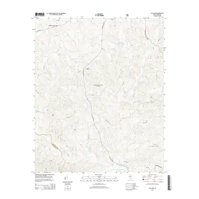
2014 Map of Colliers
USGS Topo · Published 2014About this map
Sumter National Forest blankets much of this South Carolina landscape, where the headwaters of numerous creeks carve through the timbered hills of Edgefield Co and McCormick Co. The small settlement of Colliers sits at the junction of Martintown Rd and Georgia Rd, serving as a central point for a rural network of homesteads and small family burial grounds. Local history is preserved in sites like McKie Cem and Martin Cem, which are tucked away from the main thoroughfares. To the north, Millers Crossroads marks the intersection of State Hwy 23, while the southern reaches of the map follow the winding course of Stevens Creek. This area's geography is defined by a dense drainage system, including Lick Fork Lake and the many branches of Horn Creek, which have dictated the placement of roads and property lines since the early settlement era.
Find a feature on this map
46 named features on this map. Tap any name to fly to it.
Don’t see what you’re looking for? This feature index may not catch every label — zoom into the map to look around manually.
Map Details
Editions of this 2014 Colliers Map
This is the sole edition of this map. No revisions or reprints were ever made.
Other maps of this area

1892 · Mc Cormick
USGS Topo · 1:125,000

1912 · Mc Cormick
USGS Topo · 1:125,000

1920 · Clarks Hill
USGS Topo · 1:48,000

1921 · Clarks Hill
USGS Topo · 1:62,500

1923 · Warrenville
USGS Topo · 1:48,000

1928 · Warrenville
USGS Topo · 1:62,500

1941 · Clarks Hill
USGS Topo · 1:62,500

1942 · Clarks Hill
USGS Topo · 1:62,500

1943 · Warrenville
USGS Topo · 1:62,500

1953 · Athens
USGS Topo · 1:250,000