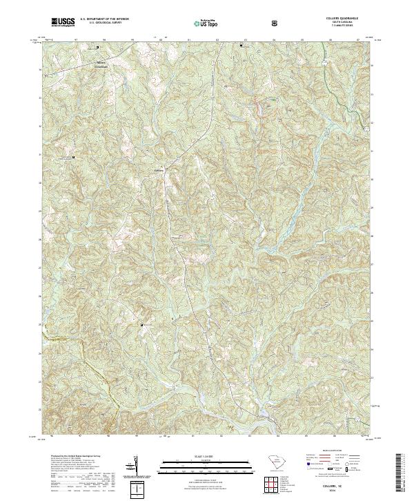
2024 Map of Colliers
USGS Topo · Published 2024About this map
Sumter National Forest dominates the terrain of this modern survey, revealing a landscape defined by the drainage basins of Stevens Creek and its many tributaries. The area around Colliers and Millers Crossroads preserves a rural character where family history is etched into the land through sites like the Poplar Spring Church Graveyard and McKie Cem.
Find a feature on this map
49 named features on this map. Tap any name to fly to it.
Don’t see what you’re looking for? This feature index may not catch every label — zoom into the map to look around manually.
Map Details
Editions of this 2024 Colliers Map
This is the sole edition of this map. No revisions or reprints were ever made.
Other maps of this area

1892 · Mc Cormick
USGS Topo · 1:125,000

1912 · Mc Cormick
USGS Topo · 1:125,000

1920 · Clarks Hill
USGS Topo · 1:48,000

1921 · Clarks Hill
USGS Topo · 1:62,500

1923 · Warrenville
USGS Topo · 1:48,000

1928 · Warrenville
USGS Topo · 1:62,500

1941 · Clarks Hill
USGS Topo · 1:62,500

1942 · Clarks Hill
USGS Topo · 1:62,500

1943 · Warrenville
USGS Topo · 1:62,500

1953 · Athens
USGS Topo · 1:250,000