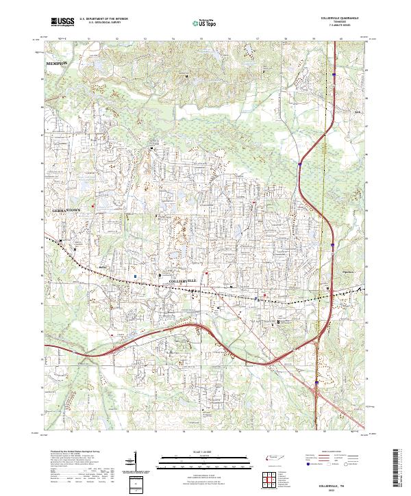
2022 Map of Collierville
USGS Topo · Published 2022About this map
The Wolf River meanders across the northern half of this landscape, forming a natural boundary near the border of Shelby and Fayette Counties. This modern record of the eastern Memphis suburbs shows the dense suburban residential development surrounding Collierville and Germantown, yet it still preserves the locations of numerous historic burial grounds that predate the modern housing tracts. Genealogists can identify small, localized family and community sites like the Bethany Cem, Kirk Family Cem, and the Bedford Plantation Cem. The southern portion of the map is defined by the Nonconnah Creek drainage system and landmarks like the Old Salem Presbyterian Church Cem. These features, along with modern additions like the Houston Levee Golf Course Lake, illustrate the complete transformation of former agricultural lands into an integrated metropolitan corridor.
Find a feature on this map
250 named features on this map. Tap any name to fly to it.
Don’t see what you’re looking for? This feature index may not catch every label — zoom into the map to look around manually.
Map Details
Editions of this 2022 Collierville Map
This is the sole edition of this map. No revisions or reprints were ever made.
Other maps of this area

1943 · Collierville
USGS Topo · 1:62,500

1944 · Hernando
USGS Topo · 1:62,500

1948 · Byhalia
USGS Topo · 1:62,500

1953 · Collierville
USGS Topo · 1:50,000

1956 · Blytheville
USGS Topo · 1:250,000

1956 · Tupelo
USGS Topo · 1:250,000

1958 · Tupelo
USGS Topo · 1:250,000

1959 · Blytheville
USGS Topo · 1:250,000

1960 · Bartlett
USGS Topo · 1:62,500

1961 · Bartlett
USGS Topo · 1:62,500