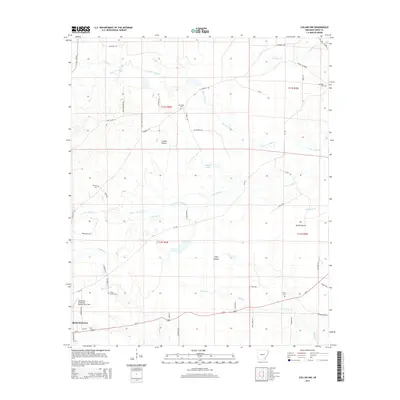
2014 Map of Collins NW
USGS Topo · Published 2014About this map
Monticello anchors the southwestern edge of this landscape, where the town's expansion meets the rural drainages of the Arkansas delta. The area is defined by a series of low-lying natural grasslands and seasonal waterways, including Cooper Prairie, Brush Prairie, and Tiffin Prairie, which have historically shaped the agricultural footprint of Drew County. The map details the transition from the municipal surroundings of the Monticello Municipal Airport/Ellis Field to the complex network of creeks that drain the territory, such as Upper Cutoff Cr, Lower Cutoff Cr, and the winding path of Piney Cr. Several legacy burial grounds, including Old Union Cem, Mt Zion Cem, and Shady Grove Cem, are distributed across the township lines, marking early settlement clusters near long-established routes like Ar-138 and Ar-4.
Find a feature on this map
60 named features on this map. Tap any name to fly to it.
Don’t see what you’re looking for? This feature index may not catch every label — zoom into the map to look around manually.
Map Details
Editions of this 2014 Collins NW Map
This is the sole edition of this map. No revisions or reprints were ever made.
Other maps of this area

1935 · Feenyville
USGS Topo · 1:62,500

1935 · Cominto
USGS Topo · 1:62,500

1935 · Rotan
USGS Topo · 1:62,500

1953 · Greenwood
USGS Topo · 1:250,000

1956 · Greenwood
USGS Topo · 1:250,000

1960 · Selma
USGS Topo · 1:24,000

1960 · Collins NW
USGS Topo · 1:24,000

1960 · Collins
USGS Topo · 1:24,000

1960 · Collins
USGS Topo · 1:62,500

1960 · Cominto
USGS Topo · 1:24,000