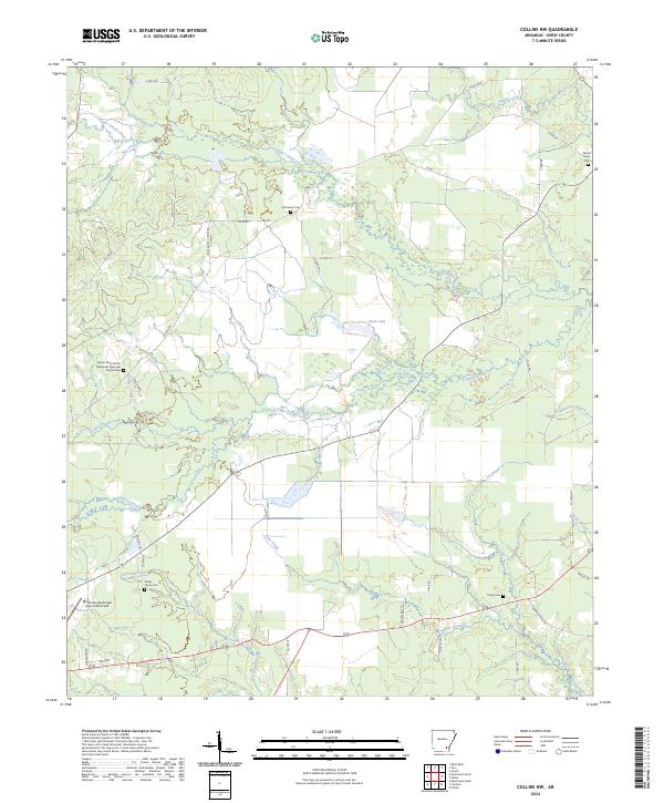
2024 Map of Collins NW
USGS Topo · Published 2024About this map
Mount Zion African Methodist Episcopal Church Cem and Shady Grove Cem anchor the social geography of this rural landscape in Drew County. The terrain is defined by a dense network of meandering waterways, including Upper Cutoff Creek, Lower Cutoff Creek, and Godfrey Creek, which slice through the timbered lowlands. These drainages converge as they move through the southeastern corner of the quadrangle, where Hurricane Creek and Piney Creek meet a series of local roads and trails.
Find a feature on this map
49 named features on this map. Tap any name to fly to it.
Don’t see what you’re looking for? This feature index may not catch every label — zoom into the map to look around manually.
Map Details
Editions of this 2024 Collins NW Map
This is the sole edition of this map. No revisions or reprints were ever made.
Other maps of this area

1935 · Feenyville
USGS Topo · 1:62,500

1935 · Cominto
USGS Topo · 1:62,500

1935 · Rotan
USGS Topo · 1:62,500

1953 · Greenwood
USGS Topo · 1:250,000

1956 · Greenwood
USGS Topo · 1:250,000

1960 · Selma
USGS Topo · 1:24,000

1960 · Collins NW
USGS Topo · 1:24,000

1960 · Collins
USGS Topo · 1:24,000

1960 · Collins
USGS Topo · 1:62,500

1960 · Cominto
USGS Topo · 1:24,000